La Paz is a fascinating city to me primarily because of its unique location and layout. First off, it is the highest seat of government in the world. Assigning an actual altitude to the city, however, is difficult because the number ranges from about 10,170 feet to 13,313 feet at the border of El Alto, where the international airport is located. What other city in the world do you know covers an altitude range of nearly 3,200 feet?
Taking a bus into La Paz from the outskirts of the city gives you a good idea of its unusual topography. As you descend from dizzying heights along the edge of town, views of the massive sprawl set inside a wide, deep canyon are simply astonishing. At the very bottom of this canyon lies the heart of the city. From here, La Paz has grown outwards and upwards, spreading beyond the slopes until it finally reached the high plateau to the west.
Because the weather and effects of altitude grow milder as you descend into the canyon, the wealthiest residential districts and business centers are all located at the bottom, while the surrounding hillsides are lined with poorer neighborhoods. At the very top, the adjacent city of El Alto sits on a flat plain with an average altitude of 13,620 feet, making it the world's highest large city. More than a million people live here, many in shanty town-like conditions, and crime and poverty are both significant issues for its residents.
With our delayed arrival into La Paz on the first day, we missed out on a late afternoon of exploring the city. So with just one full day left, we made the most of our time by visiting some of the more prominent sights in town. The weather was beautiful in the morning, and we set off along El Prado, the main street just west of our hotel. The tree-lined road is surrounded by restaurants, department stores, and apartments catering to the mostly middle-class residents of the area. Social activism, of course, plays a prominent role in daily life, and just on our walk, we witnessed a political rally as well as a tent city protest.

Start of El Prado


Political rally

Tent city protest
Further up the road is Plaza San Francisco, where the famous San Francisco Basilica is located. For 20 Bolivianos, you can take a very informative guided tour of the beautiful church grounds, which also contain quite a bit of history related to the 1809 independence movement. Best of all, the tour concludes with a climb up to the bell tower, where you can take in expansive views of the area.

San Francisco Basilica


Blue Jesus

Bell tower

Plaza San Francisco
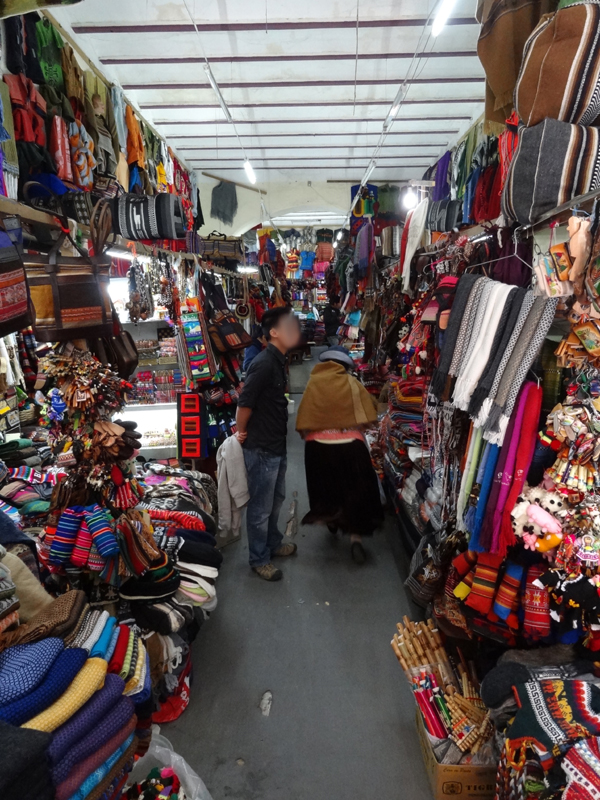
Just south of the plaza is Sagarnaga Street, a narrow corridor filled with tourist shops and artisans. This is a great place to pick up a few local souvenirs for a great price. The side streets contain more small shops, art galleries, and even a "Witches Market" on Linares Street. There, you'll find plenty of stands selling llama fetuses, dried frogs, and other peculiar items. Although frequented mostly by backpackers and tourists, Sagarnaga Street is still a fairly entertaining way to shop for local goods.

Sagarnaga Street

Murillo Street

Linares Street

Llama fetuses
A few blocks to the north lies Plaza Murillo, where the Presidential Palace, National Congress of Bolivia, and Cathedral of La Paz are all located. This plaza, in many ways, symbolizes the center of political life in the country. It also serves as a popular gathering place for locals, who relax on benches in the square or stroll along the tree-lined perimeter. This was the perfect place for us to grab some snacks from local vendors and just sit and people watch for a while.

Plaza Murillo

Pigeons galore

National Congress

Guards at the Presidential Palace
In the afternoon, we decided to climb up to Mirador Killi Killi, one of the few vista points located near the city center. Buses and taxis can take you fairly close to the lookout, but we decided to walk the entire way just for kicks. The path leading up to the mirador actually reminded me a lot of San Francisco's steep roads. Hills are definitely no laughing matter in high altitude, and it took us a few breaks and plenty of deep breaths to make it all the way to the top.
The views from Killi Killi are worth the effort though, as you are rewarded with a spectacular panorama of La Paz towards the south. On a clear day, you can see all the way to Muela del Diablo, or Devil's Tooth. The area around this distinctive geological formation is known for hiking, mountain biking, and even motorcross riding. We began our descent from the lookout when a brief shower suddenly swept through the region.

Heading up to Mirador Killi Killi

Steep roads and cute dogs

View from the top

Muela del Diablo in the distance
On the way back to the hotel, we strolled through the Parque Urbano Central, an urban renewal project completed in recent years to encourage development of green space within the suffocating central zone. This massive area is an oasis for residents of La Paz to enjoy recreational sports, performance art, open air markets, and the simple comfort of the outdoors. Like many other large cities in South America, graffiti takes on a noticeably political bent in La Paz, and there are numerous examples that could be found all over town.

Graffiti
No comments:
Post a Comment